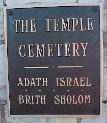
The Temple Cemetery
Also known as Adath Israel Cemetery , Congregation Adath Israel Brith Sholom , Temple Brith Sholom Cemetery
Louisville, Jefferson County, Kentucky, USA
About
-
Get directions 2716 Preston Highway
Louisville, Kentucky 40217 United StatesCoordinates: 38.21062, -85.74011 - 502-423-1818
- Cemetery ID:
Members have Contributed
Advertisement
Photos


B'rith Shalom began in 1880, started by families from Beth Israel (the predecessor of Adath Jeshurun) who wanted a more Reform, English service, rather than the traditional, German-speaking worship practiced at Beth Israel.
Adath Israel and B'rith Shalom, the two different Reform congregations, merged in 1977. The congregation's official name is The Temple-Congregation Adath Israel B'rith Shalom, but it is called, simply, The Temple.
Four of the five Jewish cemeteries in Louisville are in what is basically a cemetery complex off Preston Highway. Traveling south from downtown on Preston, the first entry point would be The Temple Cemetery. The middle entryway leads to Keneseth Israel, and the last entry point off Preston is Adath Jeshurun. The entry to Anshei Sfard is off Locust Lane, around the corner. Agudath Achim is across Preston Highway from the "cemetery complex."
The first Jewish cemetery in Louisville was the Hebrew Cemetery. When the Congregation of Hebrews became part of Adas Israel, this ground was donated to the new congregation. Adas Israel started its own cemetery in 1859, located on the southwest corner of Preston and Woodbine. In 1873, Adas Israel purchased 15 acres for a new cemetery, on Preston Highway. The old cemetery was not used after 1876, when the new cemetery was opened. In 1924, the last of the old burials from the original Adas Israel cemetery were moved to the new location. In 1955, when I-65 was built, the graves at the old Hebrew Cemetery were moved to Adath Israel Cemetery on Preston Highway.
B'rith Shalom also acquired land at Preston and Woodbine for its cemetery. The first burial at B'rith Shalom cemetery was in 1887. In 1907, approximately 400 people were disinterred from Preston and Woodbine and re-buried in B'rith Shalom's new cemetery on Preston Highway.
Adath Israel Cemetery and B'rith Shalom Cemetery, although right next to each other, were separate. After the congregations merged in 1976, a connecting road was added, and the cemeteries merged.
Although now combined, it is easy to tell which side was Adath Israel and which side was B'rith Shalom. First, the section designations make it easily distinguishable. The Adath Israel sections are designated by the letter A (for example, A-5) and the B'rith Shalom sections are designated by the letter B (for example, B-6). There is also a noticeable difference in the layout of the cemeteries. The B sections are more symmetrical, laid out in rows, while the A sections, with their more elaborate monuments, are less uniform.
Many of the burials in the Public Ground (designated as PG or B-PG) are unmarked and cannot be verified. If a name is listed in the public ground but there is no accompanying photograph, it means that those graves could not be confirmed. Similarly, many of the memorials which do not have photographs are removals from the Hebrew Cemetery, the original Adas Israel Cemetery, or the original B'rith Shalom Cemetery which, again, could not be verified.
(Ellen White 10/3/2019)
Historical information retrieved from the following sources:
Landau, Herman. Adath Louisville: The Story of a Jewish Community. Herman Landau and Assoc.,1981
Gradwohl, David M. "The Jewish Cemeteries of Louisville, Kentucky: Mirrors of Historical Processes and Theological Diversity Through 150 Years." 1993.
Courier-Journal newspaper articles
Nearby cemeteries

Louisville, Jefferson County, Kentucky, USA
- Total memorials146
- Percent photographed100%
- Percent with GPS1%

Louisville, Jefferson County, Kentucky, USA
- Total memorials1k+
- Percent photographed99%
- Percent with GPS3%

Louisville, Jefferson County, Kentucky, USA
- Total memorials2k+
- Percent photographed99%
- Percent with GPS1%

Louisville, Jefferson County, Kentucky, USA
- Total memorials1k+
- Percent photographed99%
- Percent with GPS1%
- Added: 9 Aug 2002
- Find a Grave Cemetery ID: 1494008

Cemetery Photos
This is a carousel with slides. Use Next and Previous buttons to navigate, or jump to a slide with the slide dots. Use Escape keyboard button or the Close button to close the carousel.


Success
Uploading...
Waiting...
Failed
This photo was not uploaded because this cemetery already has 20 photos
This photo was not uploaded because you have already uploaded 5 photos to this cemetery
This photo was not uploaded because you have already uploaded 5 photos to this cemetery
Invalid File Type
Birth and death years unknown.
1 photo picked...
2 photos picked...
Uploading 1 Photo
Uploading 2 Photos
1 Photo Uploaded
2 Photos Uploaded
Size exceeded
Too many photos have been uploaded
"Unsupported file type"
• ##count## of 0 memorials with GPS displayed. Double click on map to view more.No cemeteries found